
Table of Contents
Frequently Asked Questions
What is activity code 7110.80 and what does it cover in Dubai
Activity code 7110.80 refers to Geodetic Engineering Surveying Services, classified under ISIC Division 71 — Architectural and Engineering Activities. It is a specialised professional and technical category, distinct from general construction or civil engineering licences.
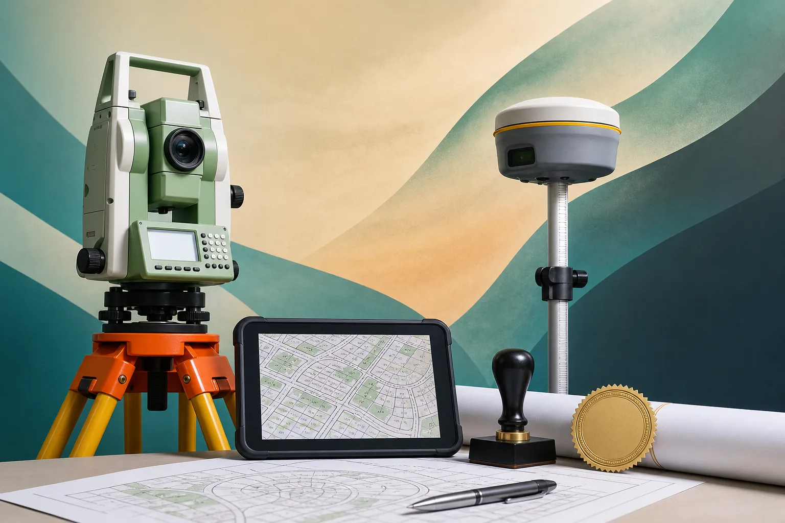
The scope covers land boundary surveys, topographic mapping, GPS/GNSS-based positioning, control network establishment, hydrographic surveys, deformation monitoring, and geospatial data processing and GIS integration.
Geodetic work is foundational to construction, infrastructure planning, utility mapping, and cadastral registration. It is a technical prerequisite on most large projects, not an optional or discretionary service.
Which regulatory bodies oversee geodetic surveying licences in Dubai
Several authorities are involved depending on the nature of the work. Dubai Municipality (DM) Engineering Department oversees technical licensing for surveying firms on the mainland and requires qualified engineers to be registered before a licence is issued. Their portal is available at www.dm.gov.ae.
If the firm intends to conduct cadastral or property boundary surveys, separate authorisation from the Dubai Land Department (DLD) is required. Details are available at www.dubailand.gov.ae.
The Dubai Economy and Tourism (DED) issues the trade licence for mainland entities, while Meydan Free Zone is an alternative jurisdiction suited to consultancy-focused structures.
What is the typical timeline to set up a geodetic engineering surveying licence in Dubai
The typical setup timeline is 2–4 weeks, though this is subject to professional body approvals, which can extend the process.
The most time-consuming step is often the credential attestation and DM registration of expatriate engineers. Expatriate professionals must have their qualifications formally attested and registered with Dubai Municipality before they can be listed as technical directors or responsible engineers on the firm's licence.
Planning for this step early — ideally before initiating the trade licence application — helps avoid delays at the approval stage.
Can a free zone licence be used for geodetic surveying work in Dubai
A free zone licence, such as one issued through Meydan Free Zone, can permit geodetic engineering surveying activity for consultancy-focused work. It offers a straightforward setup process and is suitable for firms primarily serving private sector clients.
However, client-facing work on UAE government projects typically requires a mainland DED licence. Free zone entities cannot directly contract with government bodies in most cases.
Firms targeting both government and private sector clients often adopt a dual-entity structure — a mainland LLC for government-facing contracts and a free zone entity for consultancy or international work.
Is there a minimum share capital requirement for this licence
There is no specific minimum share capital mandated by activity code 7110.80 itself. Capital requirements depend on the jurisdiction chosen — either the DED for mainland entities or the relevant free zone authority.
While capital thresholds may be low or flexible, firms should be aware that professional indemnity insurance is standard practice in the industry and is commonly required contractually by project clients, particularly on government and large-scale infrastructure projects.
Who are the typical clients for geodetic engineering surveying firms in Dubai
Geodetic surveying services are in demand across several high-value sectors. Primary clients include government infrastructure bodies, real estate developers, EPC (Engineering, Procurement, and Construction) contractors, utility companies, and oil and gas operators.
Because geodetic work is a technical prerequisite on most large-scale projects — underpinning construction positioning, cadastral registration, and utility mapping — demand is non-discretionary in nature. Dubai's ongoing mega-development and infrastructure expansion sustains consistent demand for licensed firms.
What qualifications are required for engineers listed on a geodetic surveying licence in Dubai
Licensed professionals must hold recognised engineering qualifications relevant to geodetic or surveying disciplines. The specific qualifications accepted are assessed by Dubai Municipality's Engineering Department during the registration process.
For expatriate engineers, the process involves two additional steps: formal credential attestation (verifying qualifications through the appropriate channels) and registration with Dubai Municipality before the individual can be listed as a technical director or responsible engineer on the firm's licence.
This registration step is frequently the longest part of the overall setup process, and firms are advised to initiate it as early as possible.
What is the difference between a mainland LLC and a free zone entity for this activity
The choice between a mainland LLC (licensed through DED) and a free zone entity (such as through Meydan Free Zone) depends primarily on the intended client base and project pipeline.
A mainland LLC allows the firm to contract directly with UAE government bodies, bid on public tenders, and operate across Dubai without geographic restriction. It requires DM engineer registration and DED trade licence issuance. If cadastral surveys are in scope, DLD authorisation is also needed.
A free zone entity offers a simpler setup and is well-suited to consultancy-led or private sector work. However, it typically cannot directly serve government clients. Firms with mixed pipelines often establish a dual-entity structure to cover both scenarios.
Geodetic Engineering Surveying Services License in Dubai
Dubai's rapid infrastructure expansion — from mega-developments to utility corridors — creates sustained demand for licensed geodetic engineering surveying firms operating within a tightly regulated professional framework. This guide covers what the activity entails, who the clients are, how to structure the licence correctly, and what the setup process looks like in practice.
Key Stats at a Glance
| Activity Name | Geodetic Engineering Surveying Services |
| Activity Code | 7110.80 |
| ISIC Classification | ISIC Division 71 — Architectural and Engineering Activities |
| Licence Type | Professional / Technical |
| Jurisdiction | Dubai Mainland (DED) or Free Zone (e.g. Meydan Free Zone) |
| Typical Setup Timeline | 2–4 weeks (subject to professional body approvals) |
| Regulatory Authority | Dubai Municipality Engineering Department; Dubai Land Department (DLD) for property surveys |
| Minimum Share Capital | As required by DED or free zone authority |
Free Business Setup Cost Calculator
Calculate NowWhat Geodetic Engineering Surveying Covers

Activity code 7110.80 sits within ISIC Division 71 — professional, scientific, and technical activities related to engineering and architecture. It is a specialised discipline, not a general construction or civil engineering category.
The scope includes land boundary surveys, topographic mapping, GPS/GNSS-based positioning, control network establishment, and geospatial data collection. Geodetic work is foundational — it underpins construction, infrastructure planning, utility mapping, and cadastral registration. Without it, nothing else is accurately positioned or legally recorded.
Primary clients are government infrastructure bodies, real estate developers, EPC contractors, utility companies, and oil and gas operators. The work is non-discretionary on most large projects — it is a technical prerequisite, not an optional service.
Services Typically Offered Under This Licence
- Topographic and boundary surveys for development plots
- GPS/GNSS control networks and geodetic control point establishment
- Hydrographic and deformation monitoring surveys
- Geospatial data processing and GIS integration
Regulatory Framework and Approvals in Dubai
Dubai Municipality (DM) Engineering Department oversees technical licensing for surveying firms operating on the mainland. Firms must register qualified engineers with DM before a licence is issued. The DM portal provides guidance on engineering firm registration requirements at www.dm.gov.ae.
If the firm intends to conduct cadastral or property boundary surveys, separate authorisation from the Dubai Land Department is required. Details on surveying firm registration are available at www.dubailand.gov.ae/en.
Licensed professionals must hold recognised engineering qualifications. Expatriate engineers require credential attestation and formal DM registration before they can be listed as technical directors or responsible engineers on a firm's licence. This step is often the longest in the process — plan accordingly.
A free zone licence, such as through Meydan Free Zone, permits the activity for consultancy-focused work. However, client-facing work on UAE government projects typically requires a mainland DED licence or a dual-entity structure. No specific minimum capital is mandated by the activity code, but professional indemnity insurance is standard practice and is commonly required by project clients contractually.
Key Regulatory Bodies to Engage
- Dubai Municipality — engineer registration and technical firm approval
- Dubai Land Department — cadastral survey authorisation
- Dubai Economy and Tourism / DED — trade licence issuance for mainland entities
- Meydan Free Zone — alternative jurisdiction for consultancy-led structures
Dubai Trade License from AED 12,500
Get Your LicenseStep-by-Step Licence Setup Guide
The setup process is structured. Work through each step in sequence — skipping ahead creates delays at the approval stage.
Step 1 — Define your business structure. Decide between a mainland LLC or a free zone entity. If your project pipeline includes UAE government contracts or site work requiring DM-registered engineers on the ground, mainland is the appropriate structure. Free zone suits consultancy-led operations initially.
Step 2 — Reserve your trade name. Submit your preferred name to DED or your chosen free zone authority. The name should reflect the professional and technical nature of the activity — avoid generic trading names that do not signal engineering competence.
Step 3 — Submit the initial application with activity code 7110.80. DED will flag the required external approvals from Dubai Municipality at this stage. Do not attempt to bypass this — DM approval is a hard dependency.
Step 4 — Register qualified engineers with Dubai Municipality. Submit attested academic certificates, experience records, and credentials for your geodetic or survey engineers. This is typically the longest step. DM registration queues vary — factor in two to three weeks minimum.
Step 5 — Secure office space. Mainland entities require an Ejari-registered tenancy contract. Free zone entities can operate from a flexi-desk or dedicated office depending on the package selected.
Step 6 — Obtain the DED trade licence. Once DM approval is confirmed, DED issues the licence. Register separately with DLD if cadastral services are part of your offering.
Step 7 — Apply for investor and employee visas and open your corporate bank account. UAE bank account opening for technical professional firms is straightforward with the right documentation — have your licence, tenancy contract, and shareholder documents ready.
Documents Required
- Passport copies and visa status of all shareholders and managers
- Attested engineering degree certificates and professional experience letters
- No-objection letter from current UAE sponsor (if applicable)
- Tenancy contract / Ejari for business premises
Start Your UAE Company Remotely
Get in Touch NowCommercial Opportunity and Business Model
Dubai's infrastructure pipeline is not a short-term cycle. Metro expansions, utility upgrades, urban densification under the Dubai Urban Master Plan 2040, and ongoing real estate development create sustained, non-discretionary demand for geodetic survey services across the emirate.
The revenue model is primarily project-based — contracts with government entities, retainer agreements with large developers, and subcontracting arrangements with EPC firms. Firms that differentiate through technology — drone-based LiDAR, GNSS RTK networks, BIM-integrated surveys — command premium pricing and shorter project timelines, which matters to developers working against handover deadlines.
Meydan Free Zone offers a cost-efficient entry point for consultancy-focused operations before scaling to a mainland entity with DM-registered engineers. Many firms start there, build their client base, then add a mainland licence when government project volumes justify the additional overhead.
Partnerships with civil engineering and architecture firms create natural referral pipelines. Geodetic surveying is upstream of most construction activity — position correctly and the work follows the project flow.
Why Dubai Specifically
- UAE Vision 2031 and Dubai Urban Master Plan 2040 drive sustained infrastructure spend at scale
- Strong rule of law around land registration creates non-negotiable demand for certified geodetic surveys — this is not a service that can be skipped or substituted
- Regional hub positioning allows firms to serve GCC projects from a single UAE base, with Dubai as the commercial and operational centre
Conclusion
A geodetic engineering surveying licence in Dubai sits at the intersection of professional regulation and infrastructure demand. The setup process is structured but manageable — provided you enter it with the right credentials, a clear jurisdiction strategy, and realistic timelines for DM engineer registration. The commercial case is solid: demand is structural, not cyclical, and the regulatory barrier to entry protects firms that take the process seriously.
If you are ready to set up or need clarity on the DM registration process and entity structure, speak directly with a setup adviser who knows the technical licence pathway.